Datei:Saarland location map.svg
Zur Navigation springen
Zur Suche springen

Größe der PNG-Vorschau dieser SVG-Datei: 658 × 540 Pixel. Weitere aus SVG automatisch erzeugte PNG-Grafiken in verschiedenen Auflösungen: 293 × 240 Pixel | 585 × 480 Pixel | 936 × 768 Pixel | 1.248 × 1.024 Pixel | 2.496 × 2.048 Pixel
Originaldatei (SVG-Datei, Basisgröße: 658 × 540 Pixel, Dateigröße: 45 KB)
![]()
Diese Datei und die Informationen unter dem roten Trennstrich werden aus dem zentralen Medienarchiv Wikimedia Commons eingebunden.
![]()
Beschreibung
| Beschreibung |
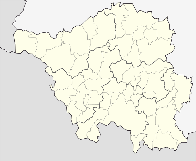
English: Position map of the state of Saarland with the six disticts and fiftytwo municipalities
Geographic limits of the map: * N: 49.65° N * S: 49.09° N * W: 6.3° E * E: 7.405° E Deutsch: Positionskarte vom Bundesland Saarland mit seinen sechs Kreisen und 52 Gemeinden Quadratische Plattkarte. Geographische Begrenzung der Karte: * N: 49.65° N * S: 49.09° N * W: 6.3° E * E: 7.405° E |
| Datum | |
| Quelle | Eigenes Werk |
| Urheber | Lantus |
| Andere Versionen |
|


Lizenz
Ich, der Urheber dieses Werkes, veröffentliche es unter der folgenden Lizenz:
Diese Datei ist unter der Creative-Commons-Lizenz „Namensnennung – Weitergabe unter gleichen Bedingungen 3.0 nicht portiert“ lizenziert.
- Dieses Werk darf von dir
- verbreitet werden – vervielfältigt, verbreitet und öffentlich zugänglich gemacht werden
- neu zusammengestellt werden – abgewandelt und bearbeitet werden
- Zu den folgenden Bedingungen:
- Namensnennung – Du musst angemessene Urheber- und Rechteangaben machen, einen Link zur Lizenz beifügen und angeben, ob Änderungen vorgenommen wurden. Diese Angaben dürfen in jeder angemessenen Art und Weise gemacht werden, allerdings nicht so, dass der Eindruck entsteht, der Lizenzgeber unterstütze gerade dich oder deine Nutzung besonders.
- Weitergabe unter gleichen Bedingungen – Wenn du das Material wiedermischst, transformierst oder darauf aufbaust, musst du deine Beiträge unter der gleichen oder einer kompatiblen Lizenz wie das Original verbreiten.
Dateiversionen
Klicke auf einen Zeitpunkt, um diese Version zu laden.
| Version vom | Vorschaubild | Maße | Benutzer | Kommentar | |
|---|---|---|---|---|---|
| aktuell | 03:25, 25. Jul. 2008 | | 658 × 540 (45 KB) | Chumwa | etwas dezentere Grenzlinien, Rahmen entfernt, Farbanpassung Rheinland-Pfalz (da selbe administrative Ebene wie Saarland) |
| 19:34, 5. Jul. 2008 |  | 826 × 679 (39 KB) | Lantus | Position map of the state of Saarland with the six disticts and fitytwo municipalities Equirectangular projection. Geographic limits of the map: * N: 49.65° N * S: 49.09° N * W: 6.3° E * E: 7.405° E Positionskarte vom Bundesland Saarl | |
| 19:18, 5. Jul. 2008 |  | 826 × 679 (39 KB) | Lantus | {{Information |Description={{en|1=Position map of the state of Saarland with the six disticts and fitytwo municipalities}} {{de|1=Positionskarte vom Bundesland Saarland mit seinen sechs Kreisen und 52 Gemeinden}} |Source=Eigenes Werk (own work) |Author=[[ |
Dateiverwendung
Die folgenden 2 Seiten verwenden diese Datei:
Globale Dateiverwendung
Die nachfolgenden anderen Wikis verwenden diese Datei:
- Verwendung auf ba.wikipedia.org
- Verwendung auf cs.wikipedia.org
- Verwendung auf da.wikipedia.org
- Verwendung auf dsb.wikipedia.org
- Verwendung auf es.wikipedia.org
- Verwendung auf gl.wikipedia.org
- Verwendung auf hy.wikipedia.org
- Verwendung auf ro.wikipedia.org
- Verwendung auf ru.wikipedia.org
- Саарбрюккен
- Зарлуи
- Беккинген
- Нонвайлер
- Энсдорф (Саар)
- Перль (Саар)
- Марпинген
- Лебах
- Вадерн
- Зульцбах (Саар)
- Шпизен-Эльферсберг
- Швальбах (Саар)
- Метлах
- Санкт-Вендель
- Толай (община)
- Пютлинген
- Диллинген (Саар)
- Нофельден
- Фридрихсталь (Саар)
- Намборн
- Квиршид
- Релинген-Зирсбург
- Иберхерн
- Зарвеллинген
- Фёльклинген
- Мерхвайлер
- Бус (Саар)
- Хомбург (Саар)
- Санкт-Ингберт
- Валлерфанген
- Нойнкирхен (Саар)
- Лосхайм-ам-Зе
- Отвайлер
- Мерциг
- Киркель
- Вадгассен
- Хойсвайлер
- Клайнблиттерсдорф
- Блискастель
- Ригельсберг
- Мандельбахталь
Weitere globale Verwendungen dieser Datei anschauen.